EAST PEORIA, Ill. – Just what was it that caused several tornadoes to touch down in Central Illinois ten years ago Friday, one of which caused major devastation to the city of Washington, along with some damage to Pekin and East Peoria?
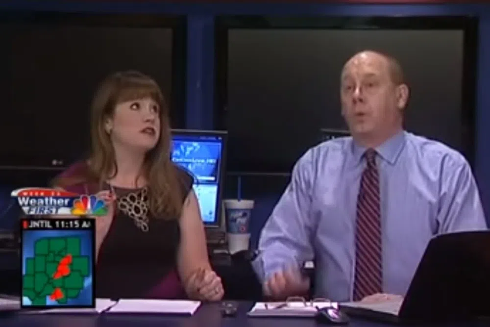
25 News First Alert Chief Meteorologist Chuck Collins tells WMBD’s Greg and Dan it was something that had been brewing in the atmosphere for the better part of at least three days.
“The big thing we look at is wind shear – that’s changing direction and wind speed at different heights of the atmosphere,” said Collins. “The ‘soundings’ we call them – which are basically balloon launches from the (National) Weather Service that relay information down from various levels of the atmosphere – had a solid what we call a ‘corkscrew.’ The atmosphere was in a corkscrew fashion all the way up.”
Collins says what that meant was a lot of rotation, and tornadoes very strong that would stick around for a while.
While Collins says the storms had been brewing for three days, and planning had been done to broadcast tornado warnings on that Sunday, he wasn’t expecting to be so close to one, as Collins and forecaster Sandy Gallant had to go off the air in order to seek their own shelter at the WEEK-TV studios in East Peoria.
“We heard the East Peoria-Washington tornado touch down at the entrance to our station on Springfield Road,” said Collins. “We had said, ‘Everybody, you’ve got to go to cover right now.’ We took cover on the air.”
Collins says when he got up that morning, nothing about the atmosphere felt right, and the storms got stronger the closer they got to central Illinois.
“To me, it felt scary out there,” said Collins. “It was too warm, it was too moist, it was too windy. It felt like April. It didn’t feel right, and you knew something was going to happen.”
The worst of the tornadoes going through the area was ranked an EF-4, with maximum winds of 140 miles per hour.


Comments